改进的'清水'大气校正算法在Landsat-5传感器中的应用
需积分: 9 86 浏览量
更新于2024-07-25
收藏 811KB PDF 举报
"A simple “clear water” atmospheric correction algorithm for Landsat-5 sensors"
这篇研究文章介绍了一种针对Landsat-5传感器的简单大气校正算法,称为改进型“清澈水体”大气校正算法(Improved Clear Water Algorithm for Broad-band sensors, 简称ICAB算法)。大气校正是遥感图像处理中的关键步骤,旨在消除大气条件对地表反射率的影响,以准确获取地表特征信息。
在ICAB算法中,研究者利用查找表方法估计了在三个可见光波段和一个近红外(NIR)波段的瑞利散射贡献。瑞利散射是大气中存在的气体分子对光线的散射现象,尤其是在短波段影响显著。此外,他们运用“清澈水”方法来估算NIR波段与气溶胶散射相关的遥感反射率。气溶胶是大气中的悬浮颗粒物,对遥感图像的准确性有显著影响。
接下来,研究者采用了安格尔斯特龙指数模型(Angstrom Exponential Model)将NIR波段的气溶胶散射贡献外推到可见光波段。这个模型常用于描述气溶胶粒子大小分布对散射光强的影响。他们还建立了一个创新的实证光谱关系,即485nm波长与560nm波长之间的关系,以估计安格尔斯特龙指数模型的指数系数。
通过在中国太湖进行的案例研究,结果显示ICAB算法计算出的光谱特性在形状和幅度上与典型的水体光谱相当接近。不过,该算法在三个可见光波段和NIR波段的不确定性分别为7.45%,10.57%,13.51%和17.14%。这些不确定性值表明,尽管ICAB算法在大气校正方面取得了良好效果,但仍有改进的空间。
ICAB算法为Landsat-5传感器的数据处理提供了一种有效的方法,有助于提高地表反射率的精度,特别是在水体监测和环境分析等领域。该算法的成功应用依赖于对大气条件、瑞利散射和气溶胶散射的精确建模,以及对安格尔斯特龙指数的有效估算。尽管存在一定的误差,但ICAB算法仍为大气校正提供了实用且相对简单的解决方案。
4 J. Chen et al.
120.4º E120.2º E120º E
120.4º
E
N
120.2º E
Taihu Lake
120º E
3
2
1
4
5
31º N 31.2º N 31.4º N
31º
N 31.2º N 31.4º N
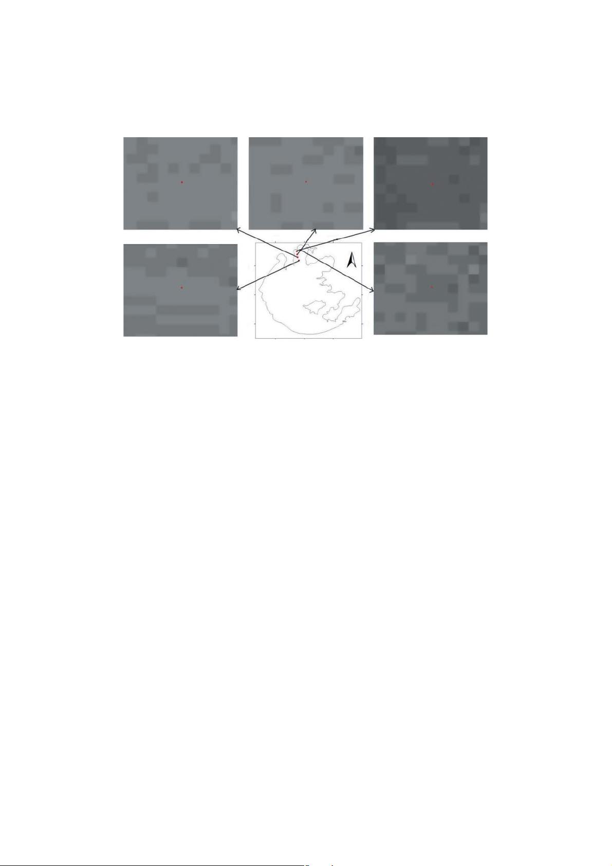
Figure 1. Transects of R
t
(TM2) at five synchronous field stations.
AQ24
COLOUR
FIGURE
using the Environment for Visualizing Images (ENVI) image processing software. The
AQ4
pixels associated with R
t
(TM2) around five synchronous field stations were selected; the
corresponding transects are shown in Figure 1. It was found that the R
t
(TM2) around the
field station was very uniform, which also supports the authors’ previous determination in
135
bio-optical experiments that the observation sites of a validation data set should be chosen
in a large area in which a generally homogeneous water colour exists.
2.3. Field measurements
The field measurements of three data sets were performed from 10:00 to 14:00 local time.
At each station, normalized water-leaving reflectance measurements were recorded from a
140
boat. The reflectance was measured with a spectroradiometer with 5
◦
fibre-optic, covering
AQ5
the spectral range of 350–2500 nm (Spectral Devices, Boulder, CO, ASD). Although data
AQ6
were collected in the range of 350-2500 nm, with a spectral resolution of 3 nm (full width
at half-maximum, FWHM) and a 1.4 nm sampling interval for the 350-1050 nm spectral
range (ASD 1999), the main data used in this study were those in the range of 400-900 nm,
145
which is the generally used wavelength for water colour remote sensing (Deng and Li 2003;
Gons, Auer, and Effler 2008; Ouaidrai and Vermote 1999). During the recording of the
measurements, the tip of the optical fibre was kept ∼1 m above the water surface by means
of a 3 m long, hand-held black pole. Radiance of both the water surface (L
sw
(λ)) and a
standard grey board (L
p
(λ)) was measured (λ is the wavelength). Ten curves were acquired 150
for each target. In order to effectively avoid the interference of the ship with the water
surface and the influence of direct solar radiation, the instrument was positioned at an
angle β of 90–135
◦
to the plane of the incident radiation and away from the Sun, as shown
AQ7
in Figure 2 (Mueller et al. 2003; Mueller and Fargion 2002). The viewing angle of the water
AQ8
surface, α, was controlled between 30
◦
and 45
◦
with the ver tical direction. In this way most
AQ9
155
of the direct sunlight was eliminated while the impact of the ship’s shadow was minimized
(Mueller et al. 2003; Mueller and Fargion 2002). Immediately after measuring the water
radiance, the spectroradiometer was rotated upwards by 90
◦
–120
◦
to measure skylight. The
AQ10
剩余15页未读,继续阅读
2013-08-22 上传
2020-06-02 上传
2023-05-10 上传
2023-06-02 上传
2023-06-28 上传
2023-06-02 上传
2023-07-10 上传
2023-05-16 上传
2023-09-06 上传

chenjun1982
- 粉丝: 1
- 资源: 11
 我的内容管理
展开
我的内容管理
展开


最新资源
- AirKiss技术详解:无线传递信息与智能家居连接
- Hibernate主键生成策略详解
- 操作系统实验:位示图法管理磁盘空闲空间
- JSON详解:数据交换的主流格式
- Win7安装Ubuntu双系统详细指南
- FPGA内部结构与工作原理探索
- 信用评分模型解析:WOE、IV与ROC
- 使用LVS+Keepalived构建高可用负载均衡集群
- 微信小程序驱动餐饮与服装业创新转型:便捷管理与低成本优势
- 机器学习入门指南:从基础到进阶
- 解决Win7 IIS配置错误500.22与0x80070032
- SQL-DFS:优化HDFS小文件存储的解决方案
- Hadoop、Hbase、Spark环境部署与主机配置详解
- Kisso:加密会话Cookie实现的单点登录SSO
- OpenCV读取与拼接多幅图像教程
- QT实战:轻松生成与解析JSON数据
